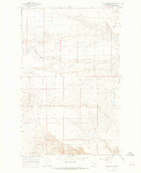
1966 Map of Squaw Buttes
USGS Topo · Published 1969About this map
Blackfeet Indian Reservation land defines this section of Glacier County, where the high plains meet significant topographic rises. The namesake Squaw Buttes dominate the southwestern quadrant, providing a notable vertical contrast to the northern Flat terrain. This mid-1960s landscape shows a transition toward modern infrastructure, centered around the Cut Bank Airport in the northeast and a scattering of natural resource extraction points, including an Oil Well and multiple Gravel Pits. Water is scarce, channeled primarily through seasonal drainages like Spring Coulee Creek and Spring Creek. The map documents a sparsely settled ranching and industrial frontier, where fine fence lines crisscross the open range, marking the intersection of traditional reservation lands with twentieth-century aviation and petroleum interests.
Find a feature on this map
12 named features on this map. Tap any name to fly to it.
Don’t see what you’re looking for? This feature index may not catch every label — zoom into the map to look around manually.
Map Details
Editions of this 1966 Squaw Buttes Map
This is the sole edition of this map. No revisions or reprints were ever made.
Other maps of this area

1907 · Blackfoot Res.
USGS Topo · 1:48,000

1909 · Cut Bank
USGS Topo · 1:125,000

1911 · Blackfoot
USGS Topo · 1:125,000

1912 · Cut Bank
USGS Topo · 1:125,000

1914 · Heart Butte
USGS Topo · 1:125,000

1918 · Heart Butte
USGS Topo · 1:125,000

1920 · Dupuyer
USGS Topo · 1:125,000

1934 · Lake Frances
USGS Topo · 1:48,000

1937 · Lake Frances
USGS Topo · 1:62,500

1960 · Cut Bank
USGS Topo · 1:250,000