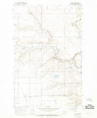
1966 Map of Gunsight
USGS Topo · Published 1969About this map
The Blackfeet Indian Reservation landscape is defined by the winding course of Cut Bank Creek and the deep incisions of Little Rock Coulee and Big Rock Coulee. This mid-century survey captures a transition in transportation and land use, with the Great Northern railroad corridor running parallel to the modest settlement at Gunsight. The presence of the Seville Community Hall reflects the local social infrastructure of this rural Montana community during the 1960s.
Find a feature on this map
16 named features on this map. Tap any name to fly to it.
Don’t see what you’re looking for? This feature index may not catch every label — zoom into the map to look around manually.
Map Details
Editions of this 1966 Gunsight Map
This is the sole edition of this map. No revisions or reprints were ever made.
Other maps of this area

1907 · Blackfoot Res.
USGS Topo · 1:48,000

1909 · Cut Bank
USGS Topo · 1:125,000

1911 · Blackfoot
USGS Topo · 1:125,000

1912 · Cut Bank
USGS Topo · 1:125,000

1960 · Cut Bank
USGS Topo · 1:250,000

1963 · Cut Bank
USGS Topo · 1:250,000

1964 · Cut Bank
USGS Topo · 1:250,000
1966 · Cut Bank
USGS Topo · 1:24,000
1966 · Cut Bank SE
USGS Topo · 1:24,000
1966 · Squaw Buttes
USGS Topo · 1:24,000