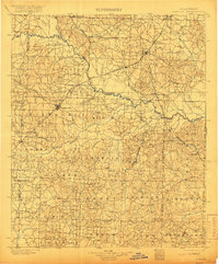
1901 Map of Gurdon
USGS Topo · Published 1916About this map
The Little Missouri River carves a winding course through Southwest Arkansas, acting as a natural boundary between Clark, Nevada, and Ouachita counties. At the turn of the century, this landscape was defined by the expansion of the timber and transport industries, centered on the major rail junction at Prescott. The St. Louis Iron Mountain and Southern R. R. serves as the primary artery for the region, connecting established timber towns like Gurdon, Beirne, and Smithton.
Find a feature on this map
85 named features on this map. Tap any name to fly to it.
Don’t see what you’re looking for? This feature index may not catch every label — zoom into the map to look around manually.
Map Details
Editions of this 1901 Gurdon Map
3 editions found
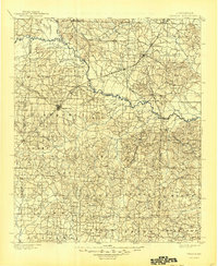
Other maps of this area

1901 · Gurdon
USGS Topo · 1:125,000

1903 · Camden
USGS Topo · 1:125,000

1906 · Caddo Gap
USGS Topo · 1:125,000

1943 · Antoine
USGS Topo · 1:62,500

1951 · Blevins
USGS Topo · 1:24,000

1951 · Patmos
USGS Topo · 1:24,000

1951 · Pisgah
USGS Topo · 1:24,000

1951 · Hope
USGS Topo · 1:24,000

1952 · Old Town
USGS Topo · 1:24,000

1953 · El Dorado
USGS Topo · 1:250,000