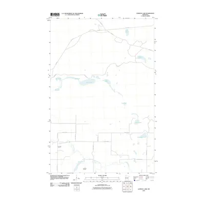
2010 Map of Gurneau Lake
USGS Topo · Published 2010About this map
Clearwater River winds through this northern Minnesota landscape, connecting a network of glacial lakes and small tributaries during the early 21st century. The terrain is defined by a distinct chain of water bodies, including First Lake, Second Lake, and continuing through Seventh Lake, reflecting the region's complex post-glacial hydrology. Local transport is facilitated by a grid of township and county routes, such as County Hwy-11 and GRW Twp Hwy 6, which serve the scattered rural properties and small clearings. For those researching local heritage, the Clearwater Cemetery stands as a significant landmark in the southwestern portion of the map, while the presence of the Bardwell Airstrip and labels like Schoolhouse Lake suggest the historical and ongoing patterns of settlement and aviation in this part of Clearwater County.
Find a feature on this map
27 named features on this map. Tap any name to fly to it.
Don’t see what you’re looking for? This feature index may not catch every label — zoom into the map to look around manually.
Map Details
Editions of this 2010 Gurneau Lake Map
This is the sole edition of this map. No revisions or reprints were ever made.
Other maps of this area

1919 · Solway
USGS Topo · 1:62,500

1919 · Churnes
USGS Topo · 1:62,500

1943 · Solway
USGS Topo · 1:62,500

1943 · Bagley
USGS Topo · 1:62,500

1954 · Bemidji
USGS Topo · 1:250,000

1957 · Bemidji
USGS Topo · 1:250,000

1958 · Bemidji
USGS Topo · 1:250,000

1969 · Clearbrook
USGS Topo · 1:24,000

1969 · Leonard
USGS Topo · 1:24,000

1972 · Bagley Lake
USGS Topo · 1:24,000