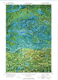
1972 Map of Gurneau Lake
USGS Topo · Published 1976About this map
The Red Lake Indian Reservation dominates the northern half of this landscape, its boundary cutting through a series of numbered water bodies from First Lake to Sixth Lake. A Winter Trail meanders through the reservation's wetlands, connecting remote points across Butcher Knife Creek. This 1972 orthophotomap provides a rare hybrid view of the terrain, combining traditional topographic contours with aerial imagery that reveals the exact texture of the forests and bogs of northern Greenwood township.
Find a feature on this map
26 named features on this map. Tap any name to fly to it.
Don’t see what you’re looking for? This feature index may not catch every label — zoom into the map to look around manually.
Map Details
Editions of this 1972 Gurneau Lake Map
This is the sole edition of this map. No revisions or reprints were ever made.
Other maps of this area

1919 · Solway
USGS Topo · 1:62,500

1919 · Churnes
USGS Topo · 1:62,500

1943 · Solway
USGS Topo · 1:62,500

1943 · Bagley
USGS Topo · 1:62,500

1954 · Bemidji
USGS Topo · 1:250,000

1957 · Bemidji
USGS Topo · 1:250,000

1958 · Bemidji
USGS Topo · 1:250,000

1969 · Clearbrook
USGS Topo · 1:24,000

1969 · Leonard
USGS Topo · 1:24,000

1972 · Bagley Lake
USGS Topo · 1:24,000