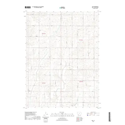
2018 Map of Guss
USGS Topo · Published 2018About this map
Guss serves as the central settlement point in this Taylor County landscape, situated amidst the agricultural grid of southwestern Iowa. The terrain is defined by the winding course of the W Fork One Hundred and Two River, which cuts through the township boundaries of t70n r35w, t70n r34w, t69n r35w, and t69n r34w. This 2018 survey reveals a rural infrastructure built on a precise network of roads such as Forest Ave and 130th St, which connect various family and community landmarks. Genealogists will find significant value in the documentation of several local burial sites, including Guss Cem near the town center, Holt Cem to the east, and both Dallas Center Cem and Ladoga Cem in the southern reaches of the quadrangle. These sites, often located at the intersections of section lines and secondary routes like Co Hwy J15, provide a clear view of the area's established heritage.
Find a feature on this map
38 named features on this map. Tap any name to fly to it.
Don’t see what you’re looking for? This feature index may not catch every label — zoom into the map to look around manually.
Map Details
Editions of this 2018 Guss Map
This is the sole edition of this map. No revisions or reprints were ever made.
Other maps of this area

1940 · Bedford
USGS Topo · 1:62,500

1940 · New Market
USGS Topo · 1:62,500

1943 · Bedford
USGS Topo · 1:62,500

1943 · New Market
USGS Topo · 1:62,500

1955 · Nebraska City
USGS Topo · 1:250,000

1957 · Nebraska City
USGS Topo · 1:250,000

1958 · Nebraska City
USGS Topo · 1:250,000

1980 · Corning South
USGS Topo · 1:24,000

1980 · Gravity
USGS Topo · 1:24,000

1980 · Guss
USGS Topo · 1:24,000