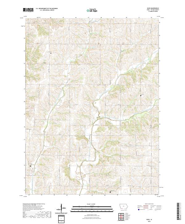
2022 Map of Guss
USGS Topo · Published 2022About this map
The unincorporated community of Guss serves as the focal point for this rural Taylor County landscape, situated near the headwaters of the One Hundred and Two River. This 2022 survey illustrates a classic Midwestern township structure, dominated by a grid of agricultural roads such as Garden Ave and 140th St that partition the rolling terrain between river forks. Genealogists will find several burial sites well-preserved in this modern layout, including the Guss Cem and Holt Cem, which serve as quiet landmarks for the area's long-established farming families. The drainage pattern is particularly distinctive, featuring the convergence of the W Fork One Hundred and Two River, the Middle Branch One Hundred and Two River, and the West Branch One Hundred and Two River, which together shape the valley's topography south of Co RD n26.
Find a feature on this map
41 named features on this map. Tap any name to fly to it.
Don’t see what you’re looking for? This feature index may not catch every label — zoom into the map to look around manually.
Map Details
Editions of this 2022 Guss Map
This is the sole edition of this map. No revisions or reprints were ever made.
Other maps of this area

1940 · Bedford
USGS Topo · 1:62,500

1940 · New Market
USGS Topo · 1:62,500

1943 · Bedford
USGS Topo · 1:62,500

1943 · New Market
USGS Topo · 1:62,500

1955 · Nebraska City
USGS Topo · 1:250,000

1957 · Nebraska City
USGS Topo · 1:250,000

1958 · Nebraska City
USGS Topo · 1:250,000

1980 · Corning South
USGS Topo · 1:24,000

1980 · Gravity
USGS Topo · 1:24,000

1980 · Guss
USGS Topo · 1:24,000