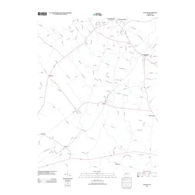
2013 Map of Guston
USGS Topo · Published 2013About this map
Brandenburg and the surrounding Meade County uplands are detailed in this 2013 survey, which illustrates a landscape defined by small communities and a dense network of country roads. The settlement of Ekron serves as a central junction for rural routes like Midway RD and Ragtown, while Guston anchors the southern portion of the sheet near Haysville. Local history is preserved in landmarks such as the Cap Anderson Cem and the residential developments of Eastwood Hills and Brandenburg Station. The terrain is marked by the course of Doe Run to the east, weaving through a mix of wooded areas and agricultural parcels. This map provides a look at the contemporary layout of these Kentucky communities, capturing the established residential patterns and named thoroughfares such as Green Acres RD and Bob Dowell RD that connect these agrarian and suburban spaces.
Find a feature on this map
123 named features on this map. Tap any name to fly to it.
Don’t see what you’re looking for? This feature index may not catch every label — zoom into the map to look around manually.
Map Details
Editions of this 2013 Guston Map
This is the sole edition of this map. No revisions or reprints were ever made.
Other maps of this area

1928 · Hardinsburg
USGS Topo · 1:48,000

1931 · Hardinsburg
USGS Topo · 1:62,500

1931 · Corydon
USGS Topo · 1:62,500

1941 · Ekron
USGS Topo · 1:62,500

1946 · Rock Haven
USGS Topo · 1:24,000

1947 · Irvington
USGS Topo · 1:24,000

1947 · Garfield
USGS Topo · 1:24,000

1947 · Mauckport
USGS Topo · 1:24,000

1947 · Hardinsburg
USGS Topo · 1:62,500

1947 · Ekron
USGS Topo · 1:62,500