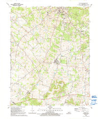
1991 Map of Guston
USGS Topo · Published 1992About this map
Brandenburg and its surrounding uplands serve as the focal point for this Meade County survey, revealing a landscape of established rural communities and evolving infrastructure in the early 1990s. The town of Ekron occupies a central position on the plateau, connected by a network of roads to smaller outlying settlements like Brandenburg Station and Guston. The map is particularly rich for genealogists, documenting numerous local landmarks such as Cap Anderson Cem and a dense collection of country churches including New Highland Ch, Weldon Ch, and Canaan Land Ch. The terrain north of Doe Run is marked by specialized land uses, including the Fish Hatchery and Meade Dist Park, indicating the area's transition toward recreational and conservation management alongside its traditional agricultural base and scattered pipelines.
Find a feature on this map
34 named features on this map. Tap any name to fly to it.
Don’t see what you’re looking for? This feature index may not catch every label — zoom into the map to look around manually.
Map Details
Editions of this 1991 Guston Map
This is the sole edition of this map. No revisions or reprints were ever made.
Other maps of this area

1928 · Hardinsburg
USGS Topo · 1:48,000

1931 · Hardinsburg
USGS Topo · 1:62,500

1931 · Corydon
USGS Topo · 1:62,500

1941 · Ekron
USGS Topo · 1:62,500

1946 · Rock Haven
USGS Topo · 1:24,000

1947 · Irvington
USGS Topo · 1:24,000

1947 · Garfield
USGS Topo · 1:24,000

1947 · Mauckport
USGS Topo · 1:24,000

1947 · Hardinsburg
USGS Topo · 1:62,500

1947 · Ekron
USGS Topo · 1:62,500