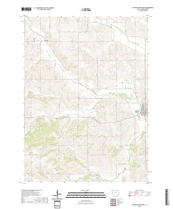
2022 Map of Guthrie Center West
USGS Topo · Published 2022About this map
The agrarian landscape of Guthrie County, Iowa, is defined here by the winding course of the South Raccoon River and its many tributaries, including Mason Creek, Seely Creek, and Brushy Creek. This area of the state is characterized by a dense network of sectional roads that navigate the drainage basins of Lone Grove Creek and Frost Creek. Near the northern border of the map, the small settlement of Wichita sits at the junction of several rural routes, serving as a local anchor for the surrounding farming community. Farther south, Bear Grove Cemetery and Seeley Township Cemetery offer significant points of interest for genealogists tracing early families in the region. The map also includes the western edge of Guthrie Center, where the Guthrie County Courthouse is located, providing a look at the county seat's modern layout and its connection to the surrounding rural townships.
Find a feature on this map
1 named feature on this map. Tap any name to fly to it.
Don’t see what you’re looking for? This feature index may not catch every label — zoom into the map to look around manually.
Map Details
Editions of this 2022 Guthrie Center West Map
This is the sole edition of this map. No revisions or reprints were ever made.
Other maps of this area

1952 · Panora
USGS Topo · 1:62,500

1954 · Bagley
USGS Topo · 1:62,500

1954 · Omaha
USGS Topo · 1:250,000

1957 · Omaha
USGS Topo · 1:250,000

1958 · Omaha
USGS Topo · 1:250,000

1971 · Coon Rapids South
USGS Topo · 1:24,000

1971 · Bayard
USGS Topo · 1:24,000

1971 · North Branch
USGS Topo · 1:24,000

1971 · Casey
USGS Topo · 1:24,000

1971 · Guthrie Center West
USGS Topo · 1:24,000