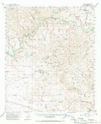
1960 Map of Guthrie
USGS Topo · Published 1970About this map
The San Francisco River and Gila River converge in this high-desert landscape, carving deep channels like the River Box and Yellowstone Canyon. This mid-century survey documents a region defined by ranching and mining, where the Southern Pacific railroad follows the river's edge past the Cemetery near Guthrie Mtn. Cultural markers of the era include the Gillard Hot Sprs and remote outposts like Subia Ranch and Harris Camp. Industrial activity is centered on the Ash Peak Mine and the Shamrock Shaft in the south, while the northern reaches transition into the elevations of Turtle Mtn. The map also captures several family-named landmarks and water-management features, including the Old Wright Monument and numerous tanks such as Tollgate Tank, essential for survival in the arid Slick Rock Basin.
Find a feature on this map
110 named features on this map. Tap any name to fly to it.
Don’t see what you’re looking for? This feature index may not catch every label — zoom into the map to look around manually.
Map Details
Editions of this 1960 Guthrie Map
2 editions found
Other maps of this area

1902 · Clifton
USGS Topo · 1:62,500

1913 · Morenci
USGS Topo · 1:125,000

1915 · Morenci
USGS Topo · 1:125,000

1954 · Silver City
USGS Topo · 1:250,000

1954 · Clifton
USGS Topo · 1:250,000

1957 · Clifton
USGS Topo · 1:250,000

1958 · Silver City
USGS Topo · 1:250,000

1958 · Clifton
USGS Topo · 1:250,000

1959 · York Valley
USGS Topo · 1:62,500

1960 · Guthrie
USGS Topo · 1:62,500