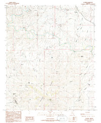
1986 Map of Guthrie
USGS Topo · Published 1986About this map
The Gila River and San Francisco River converge in this high-desert landscape, dominated by the prominent ridges of the Black Hills. This 1986 revision highlights the industrial and water-management patterns of the region, featuring the Smuggler Open Pit Mine in the north and numerous livestock or water containment sites like Peach Tree Tank and Wilkerson Tank. The settlement at Guthrie serves as a small anchor along the river, near where the elevation rises sharply toward Guthrie Mountain.
Find a feature on this map
32 named features on this map. Tap any name to fly to it.
Don’t see what you’re looking for? This feature index may not catch every label — zoom into the map to look around manually.
Map Details
Editions of this 1986 Guthrie Map
2 editions found
Other maps of this area

1902 · Clifton
USGS Topo · 1:62,500

1913 · Morenci
USGS Topo · 1:125,000

1915 · Morenci
USGS Topo · 1:125,000

1954 · Silver City
USGS Topo · 1:250,000

1954 · Clifton
USGS Topo · 1:250,000

1957 · Clifton
USGS Topo · 1:250,000

1958 · Silver City
USGS Topo · 1:250,000

1958 · Clifton
USGS Topo · 1:250,000

1959 · York Valley
USGS Topo · 1:62,500

1960 · Guthrie
USGS Topo · 1:62,500