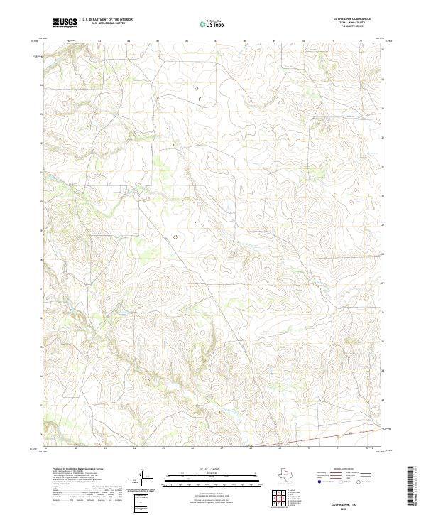
2022 Map of Guthrie NW
USGS Topo · Published 2022About this map
The arid ranching country of northwest King County is defined by a dendritic network of seasonal drainages and water management features. Long Canyon Cr and Saline Cr cut through the southern portion of the quadrangle, while Cottonwood Cr and Willow Cr drain the northern reaches. This landscape is characterized by intermittent water sources like Hackberry Tank, which are essential for livestock in this region of North Texas. The map shows a transition from the higher elevations of Buford Br in the north to the canyon systems below. Transportation is limited to a sparse grid of county roads, including Co RD 111 and Co RD 113, which provide access to these remote reaches. The southern edge of the survey is anchored by the primary east-west corridor of Highway 82 and Highway 114.
Find a feature on this map
15 named features on this map. Tap any name to fly to it.
Don’t see what you’re looking for? This feature index may not catch every label — zoom into the map to look around manually.
Map Details
Editions of this 2022 Guthrie NW Map
This is the sole edition of this map. No revisions or reprints were ever made.
Other maps of this area

1954 · Lubbock
USGS Topo · 1:250,000

1967 · Guthrie NW
USGS Topo · 1:24,000

1967 · Fourmile Hill
USGS Topo · 1:24,000

1968 · Grow
USGS Topo · 1:24,000

1968 · Pitchfork Ranch
USGS Topo · 1:24,000

1968 · Buffalo Creek
USGS Topo · 1:24,000

1968 · Dumont
USGS Topo · 1:24,000

1968 · Guthrie
USGS Topo · 1:24,000

1968 · East Afton NE
USGS Topo · 1:24,000

1968 · Pitchfork Flats
USGS Topo · 1:24,000