
1968 Map of Buffalo Creek
USGS Topo · Published 1970About this map
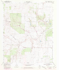
Delwin and Dumont anchor this high-plains landscape where the Cottle and King county lines meet. The terrain is deeply incised by the North Wichita River and its seasonal tributaries, creating a network of erosion-cut canyons like Water Canyon. The ranching economy of the late 1960s is evidenced by the high density of named water features and windmills, essential for livestock in this arid environment. Significant landmarks include the uniquely named Snakey Futch Windmill and Sweetness Windmill, which served as vital navigation points for local residents.
Find a feature on this map
28 named features on this map. Tap any name to fly to it.
Don’t see what you’re looking for? This feature index may not catch every label — zoom into the map to look around manually.
Map Details
Editions of this 1968 Buffalo Creek Map
2 editions found
Other maps of this area

1954 · Lubbock
USGS Topo · 1:250,000

1967 · Guthrie NW
USGS Topo · 1:24,000

1967 · Fourmile Hill
USGS Topo · 1:24,000

1968 · Grow
USGS Topo · 1:24,000

1968 · Grow NW
USGS Topo · 1:24,000

1968 · Dumont
USGS Topo · 1:24,000
1968 · Ginsite
USGS Topo · 1:24,000

1968 · China Canyon
USGS Topo · 1:24,000

1968 · East Afton NE
USGS Topo · 1:24,000

1985 · Dickens
USGS Topo · 1:100,000