
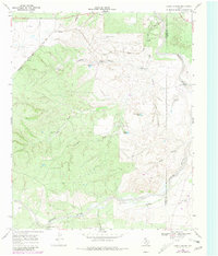
1968 Map of China Canyon
USGS Topo · Published 1971About this map
The South Pease River and its intricate network of drainage canyons define this portion of the Texas Panhandle during the late 1960s. The landscape is dominated by the China Canyon system and the Quanah Acme and Pacific railroad, which cuts through the northern section near Summit. This era of ranching is clearly documented through numerous functional improvements across the terrain, including the Swenson Ranch and a series of named water sources and pumping stations such as the Eastman Windmill and Upper China Windmill. The topography reveals a complex erosional environment where Thief Hollow and Spring Canyon feed into the broader river valley. The map provides a look at the essential infrastructure of West Texas cattle country, from the T-Fortyone Tank to the Middle Windmill, illustrating how water management dictated the use of these draws and breaks.
Find a feature on this map
25 named features on this map. Tap any name to fly to it.
Don’t see what you’re looking for? This feature index may not catch every label — zoom into the map to look around manually.
Map Details
Editions of this 1968 China Canyon Map
2 editions found
Other maps of this area

1954 · Lubbock
USGS Topo · 1:250,000

1954 · Plainview
USGS Topo · 1:250,000

1958 · Plainview
USGS Topo · 1:250,000

1966 · Ballard Camp
USGS Topo · 1:24,000

1966 · Tee Pee City
USGS Topo · 1:24,000

1966 · Devils Canyon
USGS Topo · 1:24,000

1968 · Buffalo Creek
USGS Topo · 1:24,000

1968 · Russellville
USGS Topo · 1:24,000

1968 · Grow NW
USGS Topo · 1:24,000

1968 · Dumont
USGS Topo · 1:24,000