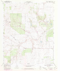
1968 Map of Buffalo Creek
USGS Topo · Published 1981About this map
The North Wichita River snakes across this high plains landscape at the border of Cottle and King Counties, carving through a network of canyons and drainages. The area is defined by its ranching infrastructure, characterized by numerous family-named landmarks and water sources. Scattered settlements like Dumont, Delwin, and Finney serve as anchor points in a region where survival depends on the strategic placement of wells and tanks.
Find a feature on this map
26 named features on this map. Tap any name to fly to it.
Don’t see what you’re looking for? This feature index may not catch every label — zoom into the map to look around manually.
Map Details
Editions of this 1968 Buffalo Creek Map
2 editions found
Other maps of this area

1954 · Lubbock
USGS Topo · 1:250,000

1967 · Guthrie NW
USGS Topo · 1:24,000

1967 · Fourmile Hill
USGS Topo · 1:24,000

1968 · Grow
USGS Topo · 1:24,000

1968 · Buffalo Creek
USGS Topo · 1:24,000

1968 · Grow NW
USGS Topo · 1:24,000

1968 · Dumont
USGS Topo · 1:24,000
1968 · Ginsite
USGS Topo · 1:24,000

1968 · China Canyon
USGS Topo · 1:24,000

1968 · East Afton NE
USGS Topo · 1:24,000