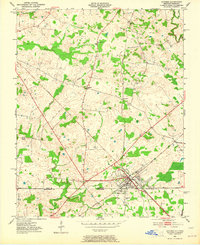
1950 Map of Guthrie
USGS Topo · Published 1964About this map
Guthrie serves as the focal point of this mid-century survey, positioned directly on the boundary between Kentucky and Tennessee. The town is a critical hub for the Louisville and Nashville railroad, which branches across the landscape to connect smaller settlements like Hadensville and Pinghem. This rail-and-road network defines the region's movement, carving through a landscape of creek-fed bottomlands and wooded rises.
Find a feature on this map
22 named features on this map. Tap any name to fly to it.
Don’t see what you’re looking for? This feature index may not catch every label — zoom into the map to look around manually.
Map Details
Editions of this 1950 Guthrie Map
3 editions found
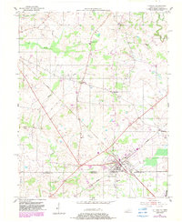
Other maps of this area

1944 · Clarksville
USGS Topo · 1:50,000

1950 · Allensville
USGS Topo · 1:24,000

1950 · Guthrie
USGS Topo · 1:24,000

1950 · Pembroke
USGS Topo · 1:24,000

1950 · Olmstead
USGS Topo · 1:24,000

1951 · Pembroke
USGS Topo · 1:24,000

1951 · Elkton
USGS Topo · 1:24,000

1951 · Olmstead
USGS Topo · 1:24,000

1951 · Hammacksville
USGS Topo · 1:24,000

1951 · Clarksville
USGS Topo · 1:24,000