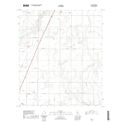
2020 Map of Guy
USGS Topo · Published 2020About this map
The Calcasieu River winds through the northwestern corner of this Allen Parish landscape, defining a terrain of numerous creeks and gullies. To the south, the settlement of Oberlin serves as a focal point, while the smaller communities of Foley and Ward are situated along the primary transportation corridor of US Highway 165. The rural character of the area is underscored by the presence of family-named landmarks and local cemeteries, such as Reed Cem, McGee Cem, and Deshotel Cem, which provide essential touchpoints for genealogical research. The Allen Parish Airport stands as a significant modern landmark north of Ward. The network of watercourses, including Chinquapin Cr, Mitchell Cr, and Duplechien Gully, illustrates the intricate drainage patterns that have historically influenced the placement of farms and roads in this part of Louisiana.
Find a feature on this map
49 named features on this map. Tap any name to fly to it.
Don’t see what you’re looking for? This feature index may not catch every label — zoom into the map to look around manually.
Map Details
Editions of this 2020 Guy Map
This is the sole edition of this map. No revisions or reprints were ever made.
Other maps of this area

1935 · Beaver
USGS Topo · 1:31,680

1935 · Oakdale
USGS Topo · 1:31,680

1942 · Oakdale
USGS Topo · 1:62,500

1947 · Fruge Lake
USGS Topo · 1:31,680

1947 · Foley
USGS Topo · 1:31,680

1947 · Oberlin
USGS Topo · 1:31,680

1947 · Pine Chapel
USGS Topo · 1:31,680

1947 · Bond
USGS Topo · 1:31,680

1947 · Elizabeth
USGS Topo · 1:31,680

1948 · Elizabeth
USGS Topo · 1:24,000