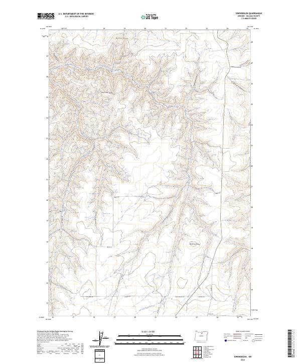
2024 Map of Gwendolen
USGS Topo · Published 2024About this map
Wester Butte and Hay Creek Butte rise above a landscape defined by the deep incisions of Gwendolen Canyon and Road Canyon. This portion of Gilliam County exhibits the characteristic drainage patterns of the high plateau, where the Dry Fork Hay Creek and the South Fork Rock Creek carve through the basalt-heavy terrain. The map captures a contemporary network of agricultural and ranching access roads, including Old Condon Rd, Jaeger Rd, and Beeks Ln, which link the high ridgetops and sheltered draws. The prominence of features like Bulls Eye Butte and Coyote Hollow reflects the enduring reliance on terrain-based navigation in this sparsely populated region of Oregon. This survey serves as a precise record of the land contours and rural infrastructure as they exist today.
Find a feature on this map
25 named features on this map. Tap any name to fly to it.
Don’t see what you’re looking for? This feature index may not catch every label — zoom into the map to look around manually.
Map Details
Editions of this 2024 Gwendolen Map
This is the sole edition of this map. No revisions or reprints were ever made.
Other maps of this area

1916 · Condon
USGS Topo · 1:125,000

1953 · The Dalles
USGS Topo · 1:250,000

1956 · The Dalles
USGS Topo · 1:250,000

1957 · The Dalles
USGS Topo · 1:250,000

1970 · Devils Backbone
USGS Topo · 1:24,000
1970 · Wolf Hollow Falls
USGS Topo · 1:24,000

1970 · Igo Butte
USGS Topo · 1:24,000
1970 · Schott Canyon
USGS Topo · 1:24,000

1970 · Condon
USGS Topo · 1:24,000
1970 · Gwendolen
USGS Topo · 1:24,000