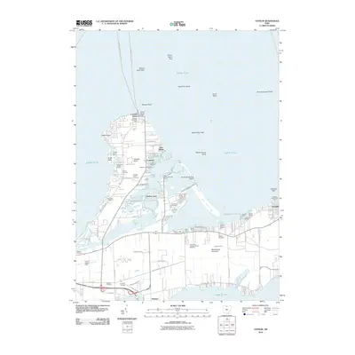
2010 Map of Gypsum
USGS Topo · Published 2010About this map
Catawba Island and the western edge of the Marblehead Peninsula define this coastal landscape along the shores of Lake Erie. The area is characterized by a dense network of maritime infrastructure and recreational settlements, with numerous marinas such as Treasure Cove Marina, Winkes Marina, and Limpert Marina dotting the inlets. The interior of the island reveals a long-standing agricultural and community legacy, anchored by Bergman Orchards and the Catawba Island Post Office.
Find a feature on this map
72 named features on this map. Tap any name to fly to it.
Don’t see what you’re looking for? This feature index may not catch every label — zoom into the map to look around manually.
Map Details
Editions of this 2010 Gypsum Map
This is the sole edition of this map. No revisions or reprints were ever made.
Other maps of this area

1901 · Put-In-Bay
USGS Topo · 1:62,500

1901 · Bellevue
USGS Topo · 1:62,500

1903 · Bellevue
USGS Topo · 1:62,500

1903 · Put In Bay
USGS Topo · 1:62,500

1904 · Sandusky
USGS Topo · 1:62,500

1916 · Kelleys Island
USGS Topo · 1:62,500

1919 · Kelleys Island
USGS Topo · 1:62,500

1956 · Toledo
USGS Topo · 1:250,000

1957 · Vickery
USGS Topo · 1:24,000

1959 · Sandusky
USGS Topo · 1:24,000
Featured Places
- Catawba Island, OH
- Put-in-Bay Township, OH
- Catawba Island Township, OH
- Lakeside, OH
- Danbury Township, OH