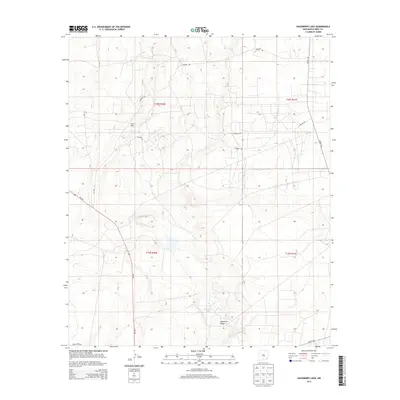
2013 Map of Hackberry Lake
USGS Topo · Published 2013About this map
Loco Hills sits in the northwest corner of this high-desert landscape in Eddy County, where the topography is defined by subtle depressions and low rises. A network of local infrastructure, including Grubbs Rd and Co Road 250, provides access to the oil and gas fields that characterize this portion of the Permian Basin. The terrain gently descends toward Hackberry Lake and the prominent limestone-capped Nimenim Ridge, highlighting the drainage patterns of the Chihuahuan Desert. Significant thoroughfares like NM-360 and Co Hwy 222 intersect the region, connecting isolated industrial sites and livestock operations. This 2013 survey documents the intersection of natural features like the ridge with the extensive road network required for regional energy extraction and ranching.
Find a feature on this map
13 named features on this map. Tap any name to fly to it.
Don’t see what you’re looking for? This feature index may not catch every label — zoom into the map to look around manually.
Map Details
Editions of this 2013 Hackberry Lake Map
This is the sole edition of this map. No revisions or reprints were ever made.
Other maps of this area

1942 · Clayton Basin
USGS Topo · 1:62,500

1943 · Clayton Basin
USGS Topo · 1:62,500

1943 · Oil City
USGS Topo · 1:62,500

1954 · Carlsbad
USGS Topo · 1:250,000

1954 · Hobbs
USGS Topo · 1:250,000

1955 · Red Lake SE
USGS Topo · 1:24,000

1958 · Carlsbad
USGS Topo · 1:250,000

1958 · Hobbs
USGS Topo · 1:250,000

1963 · Maljamar
USGS Topo · 1:62,500

1978 · Artesia
USGS Topo · 1:100,000