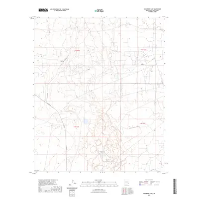
2023 Map of Hackberry Lake
USGS Topo · Published 2023About this map
Loco Hills and the adjacent Nimenim Ridge define this Eddy County landscape, where the Chihuahuan Desert terrain is marked by a complex network of industrial and recreational paths. The area is anchored by Hackberry Lake, surrounded by an extensive trail network including the Hackberry Trl System - Outer Loop Trl, Hackberry Trl System - Rail Trl, and Hackberry Trl System - Adams Trl. This modern survey illustrates how energy extraction and recreation coexist, with numerous unnamed industrial sites connected by Duvall Shaft Rd, Shugart Rd, and Bluestem Rd. The Public Land Survey System grid provides a clear framework for locating specific oil and gas infrastructure throughout T18S and T19S, making it a valuable resource for land researchers and mineral interest holders.
Find a feature on this map
20 named features on this map. Tap any name to fly to it.
Don’t see what you’re looking for? This feature index may not catch every label — zoom into the map to look around manually.
Map Details
Editions of this 2023 Hackberry Lake Map
This is the sole edition of this map. No revisions or reprints were ever made.
Other maps of this area

1942 · Clayton Basin
USGS Topo · 1:62,500

1943 · Clayton Basin
USGS Topo · 1:62,500

1943 · Oil City
USGS Topo · 1:62,500

1954 · Carlsbad
USGS Topo · 1:250,000

1954 · Hobbs
USGS Topo · 1:250,000

1955 · Red Lake SE
USGS Topo · 1:24,000

1958 · Carlsbad
USGS Topo · 1:250,000

1958 · Hobbs
USGS Topo · 1:250,000

1963 · Maljamar
USGS Topo · 1:62,500

1978 · Artesia
USGS Topo · 1:100,000