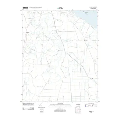
2010 Map of Hackney
USGS Topo · Published 2010About this map
Chocowinity Creek defines the low-lying interior of this coastal plain landscape south of Washington, North Carolina. The map depicts a region characterized by numerous named tributaries and drainage runs, such as Gum Swamp Run, Hog Hole Branch, and Cindy Edwards Branch, which feed into the wider systems near the Pamilco River. Small rural settlements like Hackney, McConnell, and Rover are connected by a network of local roads, including the descriptive Possum Track Rd and Haw Branch Church Rd.
Find a feature on this map
62 named features on this map. Tap any name to fly to it.
Don’t see what you’re looking for? This feature index may not catch every label — zoom into the map to look around manually.
Map Details
Editions of this 2010 Hackney Map
This is the sole edition of this map. No revisions or reprints were ever made.
Other maps of this area

1902 · Vanceboro
USGS Topo · 1:62,500

1903 · Chocowinity
USGS Topo · 1:62,500

1904 · Vanceboro
USGS Topo · 1:62,500

1905 · Chocowinity
USGS Topo · 1:62,500

1905 · Vanceboro
USGS Topo · 1:62,500

1943 · Plymouth
USGS Topo · 1:125,000

1950 · Edward
USGS Topo · 1:24,000

1951 · Bunyan
USGS Topo · 1:24,000

1951 · Hackney
USGS Topo · 1:24,000

1951 · Washington
USGS Topo · 1:24,000