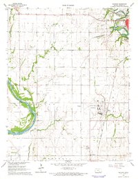
1965 Map of Hackney
USGS Topo · Published 1966About this map
Strother Airport anchors the central landscape of this Cowley County survey, situated between the settlements of Hackney and Tresham. The region is defined by a dense intersection of river-and-rail infrastructure, where the Walnut River joins the Arkansas River near the bend of the Atchison Topeka and Santa Fe railroad. To the northeast, the outskirts of Winfield reveal a suburban transition featuring the Drive-in Theater and the Tunnel Mill Dam along the river.
Find a feature on this map
38 named features on this map. Tap any name to fly to it.
Don’t see what you’re looking for? This feature index may not catch every label — zoom into the map to look around manually.
Map Details
Editions of this 1965 Hackney Map
2 editions found
Other maps of this area

1889 · Burden
USGS Topo · 1:125,000

1890 · Wellington
USGS Topo · 1:125,000

1955 · Wichita
USGS Topo · 1:250,000

1958 · Wichita
USGS Topo · 1:250,000

1965 · Silverdale
USGS Topo · 1:24,000

1965 · Arkansas City
USGS Topo · 1:24,000

1965 · Adamsville
USGS Topo · 1:24,000

1965 · Geuda Springs
USGS Topo · 1:24,000

1965 · Winfield
USGS Topo · 1:24,000
1965 · New Salem
USGS Topo · 1:24,000