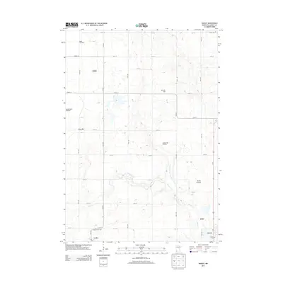
2013 Map of Hadley
USGS Topo · Published 2013About this map
Hadley and the western edge of Slayton anchor this survey of the Murray County plains, a landscape defined by its glacial history. Situated along the prominent Coteau des Prairies upland, the area is notable for its numerous lakebeds, such as the Great Oasis Lakebed and Rush Lakebed, which have been largely reclaimed for agriculture. The serpentine path of Beaver Creek winds through the southern townships, while the man-made County Ditch Number Eighteen reflects the extensive drainage efforts required to transform this wetland-heavy terrain into productive farmland. Genealogists will find several key burial sites including Highland Home Cem and Modum Cem. The map also captures smaller locales like Lowville and the specialized Stonegate Orchard, providing a clear view of rural settlement patterns in the early 21st century.
Find a feature on this map
35 named features on this map. Tap any name to fly to it.
Don’t see what you’re looking for? This feature index may not catch every label — zoom into the map to look around manually.
Map Details
Editions of this 2013 Hadley Map
This is the sole edition of this map. No revisions or reprints were ever made.
Other maps of this area

1953 · New Ulm
USGS Topo · 1:250,000

1954 · Fairmont
USGS Topo · 1:250,000

1957 · New Ulm
USGS Topo · 1:250,000

1958 · New Ulm
USGS Topo · 1:250,000

1958 · Fairmont
USGS Topo · 1:250,000

1967 · New Ulm
USGS Topo · 1:250,000

1967 · Balaton
USGS Topo · 1:24,000

1967 · Slayton
USGS Topo · 1:24,000
1967 · Balaton SW
USGS Topo · 1:24,000

1967 · Hadley
USGS Topo · 1:24,000