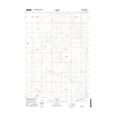
2016 Map of Hadley
USGS Topo · Published 2016About this map
Hadley sits at the southwestern edge of this Murray County landscape, a region defined by the high ground of the Coteau des Prairies and an extensive network of drainage. The terrain reveals a fascinating hydrological history, marked by numerous former water bodies such as Great Oasis Lakebed, Rush Lakebed, Crooked Lakebed, and Beauty Lakebed. These drained basins, once prominent prairie lakes, are now part of a managed agricultural system supported by County Ditch Number Eighteen and Beaver Cr.
Find a feature on this map
38 named features on this map. Tap any name to fly to it.
Don’t see what you’re looking for? This feature index may not catch every label — zoom into the map to look around manually.
Map Details
Editions of this 2016 Hadley Map
This is the sole edition of this map. No revisions or reprints were ever made.
Other maps of this area

1953 · New Ulm
USGS Topo · 1:250,000

1954 · Fairmont
USGS Topo · 1:250,000

1957 · New Ulm
USGS Topo · 1:250,000

1958 · New Ulm
USGS Topo · 1:250,000

1958 · Fairmont
USGS Topo · 1:250,000

1967 · New Ulm
USGS Topo · 1:250,000

1967 · Balaton
USGS Topo · 1:24,000

1967 · Slayton
USGS Topo · 1:24,000
1967 · Balaton SW
USGS Topo · 1:24,000

1967 · Hadley
USGS Topo · 1:24,000