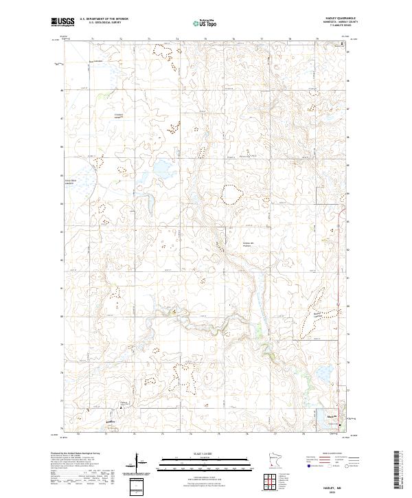
2022 Map of Hadley
USGS Topo · Published 2022About this map
Hadley and the western edge of Slayton anchor this corner of Murray County, situated atop the prominent Coteau des Prairies upland. The landscape is defined by its glacial history, evidenced by a series of significant dry basins including Great Oasis Lakebed, Rush Lakebed, Crooked Lakebed, and Beauty Lakebed. These features, along with Poverty Hill, reflect the unique drainage patterns of the region where Beaver Cr and County Ditch Number Eighteen move water across the high plains. Genealogists will find several notable burial sites documented, such as Highland Home Cem near Hadley and Slayton Cem to the east. The map provides a precise look at the township and range system, marking boundaries for t107n r42w and surrounding sections, while a rigid grid of rural roads like Co HWY 30 and 141st ST connects the scattered farmsteads.
Find a feature on this map
40 named features on this map. Tap any name to fly to it.
Don’t see what you’re looking for? This feature index may not catch every label — zoom into the map to look around manually.
Map Details
Editions of this 2022 Hadley Map
This is the sole edition of this map. No revisions or reprints were ever made.
Other maps of this area

1953 · New Ulm
USGS Topo · 1:250,000

1954 · Fairmont
USGS Topo · 1:250,000

1957 · New Ulm
USGS Topo · 1:250,000

1958 · New Ulm
USGS Topo · 1:250,000

1958 · Fairmont
USGS Topo · 1:250,000

1967 · New Ulm
USGS Topo · 1:250,000

1967 · Balaton
USGS Topo · 1:24,000

1967 · Slayton
USGS Topo · 1:24,000
1967 · Balaton SW
USGS Topo · 1:24,000

1967 · Hadley
USGS Topo · 1:24,000