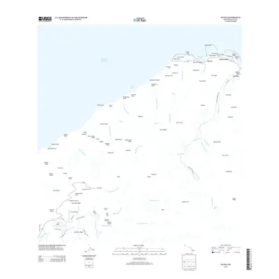
2013 Map of Haena
USGS Topo · Published 2013About this map
The northern coastline of Kauai is defined here by the meeting of the Pacific Ocean and the iconic Napali coast. High-altitude wetlands and dense drainage networks characterize the interior, where the Waineke Swamp feeds into numerous watercourses like the Kawaikōī Stream and Maluapopoki Stream. The map reveals the early 21st-century footprint of coastal settlements such as Ha'ena, Wainiha, and Halehomaha, which are linked by roads like Alamoo Rd and Alealea Rd. Cultural and recreational sites are prominent, including the Kaulupā'oa Heiau near the shore and interior retreats like Camp Sloggett and Sugi Grove Camp. The dramatic topography is punctuated by vertical drops such as Hanakāpī'ai Falls and Limahuli Falls, while the southern reaches of the sheet capture a portion of the world-renowned Waimea Canyon and the high ridges of Kokee State Park.
Find a feature on this map
115 named features on this map. Tap any name to fly to it.
Don’t see what you’re looking for? This feature index may not catch every label — zoom into the map to look around manually.
Map Details
Editions of this 2013 Haena Map
This is the sole edition of this map. No revisions or reprints were ever made.
Other maps of this area

1954 · Kauai
USGS Topo · 1:250,000

1963 · Hanalei
USGS Topo · 1:24,000

1965 · Waimea Canyon
USGS Topo · 1:24,000

1965 · Haena
USGS Topo · 1:24,000

1965 · Makaha Point
USGS Topo · 1:24,000

1965 · Waialeale
USGS Topo · 1:24,000

1967 · Kauai
USGS Topo · 1:250,000

1970 · Kauai
USGS Topo · 1:250,000
1983 · Hanalei
USGS Topo · 1:24,000
1983 · Haena
USGS Topo · 1:24,000