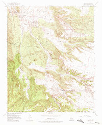
1954 Map of Hagan
USGS Topo · Published 1975About this map
Hagan and other remnants of a former mining and ranching corridor define this mid-century landscape in Sandoval County. The survey records the skeletal remains of the local economy, from the Coal Mines that once powered the region to the Old Railroad Grade that served them. Ancient history is visible at Tonque Pueblo, while the more recent mining era is marked by the deserted settlements of Coyote and Tejon. These sites, along with the Tejon Cemetery, provide critical evidence for genealogists and local historians tracking the families who inhabited the Town of Tejon Grant. The terrain is deeply incised by drainages like Arroyo Tonque and Cañon Gonzales, which run from the high ground of the Cibola National Forest toward the San Felipe Indian Reservation.
Find a feature on this map
35 named features on this map. Tap any name to fly to it.
Don’t see what you’re looking for? This feature index may not catch every label — zoom into the map to look around manually.
Map Details
Editions of this 1954 Hagan Map
Other maps of this area

1892 · San Pedro
USGS Topo · 1:125,000

1954 · Sandia Crest
USGS Topo · 1:24,000

1954 · San Felipe Pueblo
USGS Topo · 1:24,000

1954 · Placitas
USGS Topo · 1:24,000

1954 · Sandia Park
USGS Topo · 1:24,000

1954 · San Pedro
USGS Topo · 1:24,000

1954 · San Felipe Pueblo NE
USGS Topo · 1:24,000

1954 · Hagan
USGS Topo · 1:24,000

1954 · San Felipe Pueblo
USGS Topo · 1:62,500

1956 · Edgewood
USGS Topo · 1:62,500