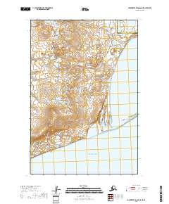
2018 Map of Hagemeister Island C-5 NE
USGS Topo · Published 2018About this map
Asigyukpak Spit extends into the Pacific Ocean, forming a distinctive coastal boundary in this remote region of the Bethel Census Area. The landscape is dominated by complex wetland networks and low-lying coastal terrain, characterized by numerous small, unnamed lakes and subtle topographical rises. The presence of Norseman Lake and Clere Bower illustrates the intricate hydrography of the Alaskan coastline, where land and water shift in a delicate balance. This survey captures the jurisdictional transition between the Dillingham Census Area and its neighboring district, providing a clear record of administrative boundaries across an largely unsettled wilderness. The vast coastal plain shown here reveals a topography shaped by tidal influence and glacial history, essential for understanding the environmental geography of Hagemeister Island and its surroundings.
Find a feature on this map
12 named features on this map. Tap any name to fly to it.
Don’t see what you’re looking for? This feature index may not catch every label — zoom into the map to look around manually.
Map Details
Editions of this 2018 Hagemeister Island C-5 NE Map
This is the sole edition of this map. No revisions or reprints were ever made.
Other maps of this area

1948 · Hagemeister Island C-4
USGS Topo · 1:63,360

1948 · Hagemeister Island C-5
USGS Topo · 1:63,360

1950 · Hagemeister Island D-5
USGS Topo · 1:63,360

1951 · Hagemeister Island
USGS Topo · 1:250,000
1952 · Hagemeister Island C-5
USGS Topo · 1:63,360

1952 · Hagemeister Island C-4
USGS Topo · 1:63,360

1954 · Hagemeister Island D-5
USGS Topo · 1:63,360

1954 · Hagemeister Island D-4
USGS Topo · 1:63,360

1957 · Hagemeister Island
USGS Topo · 1:250,000
2018 · Hagemeister Island C-4 NW
USGS Topo · 1:25,000