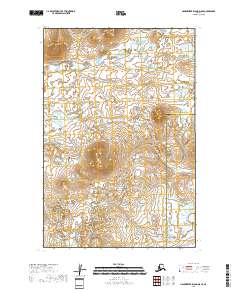
2018 Map of Hagemeister Island D-5 SE
USGS Topo · Published 2018About this map
Unaluk River winds through a landscape of extensive wetlands and glacial terrain at the boundary of southwest Alaska’s most significant administrative divisions. This 2018 survey documents the intersection of the Bethel Census Area and the Dillingham Census Area, a remote region defined by a complex network of seasonal water bodies and low-lying marshes. The mapping of the Unaluk River corridor provides a clear view of the drainage patterns essential to the local ecosystem. While devoid of named settlements, the map details the precise township and range divisions including t15s r73w and t16s r73w, which are vital for understanding land tenure and historical resource management in this coastal Alaskan interior.
Find a feature on this map
6 named features on this map. Tap any name to fly to it.
Don’t see what you’re looking for? This feature index may not catch every label — zoom into the map to look around manually.
Map Details
Editions of this 2018 Hagemeister Island D-5 SE Map
This is the sole edition of this map. No revisions or reprints were ever made.
Other maps of this area

1948 · Hagemeister Island C-4
USGS Topo · 1:63,360

1948 · Hagemeister Island C-5
USGS Topo · 1:63,360

1950 · Hagemeister Island D-5
USGS Topo · 1:63,360

1951 · Hagemeister Island
USGS Topo · 1:250,000
1952 · Hagemeister Island C-5
USGS Topo · 1:63,360

1952 · Hagemeister Island C-4
USGS Topo · 1:63,360

1954 · Hagemeister Island D-5
USGS Topo · 1:63,360

1954 · Hagemeister Island D-4
USGS Topo · 1:63,360

1957 · Hagemeister Island
USGS Topo · 1:250,000
2018 · Hagemeister Island C-4 NW
USGS Topo · 1:25,000