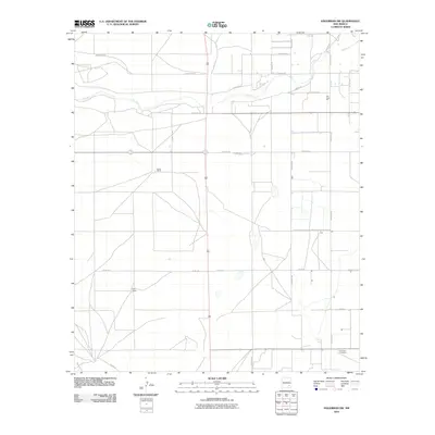
2010 Map of Hagerman SW
USGS Topo · Published 2010About this map
Hurst Ranch and Hill Ranch anchor this corner of Chaves County, where a grid of rural roads defines the arid landscape. The path of the Rio Felix cuts through the northern sections, showing the vital role of seasonal waterways in this agricultural and ranching district. Near the river, the Rio Felix Pit indicates local industrial extraction, while the southern edge of the quadrangle is marked by the Lake Arthur Cemetery. The road network, including Choctaw Rd and Cherokee Rd, reflects the organized land partitioning common to the Pecos River Valley. These survey lines connect scattered ranching operations and water features like Walnut Cr, providing a precise look at the rural infrastructure of New Mexico at the start of the twenty-first century.
Find a feature on this map
26 named features on this map. Tap any name to fly to it.
Don’t see what you’re looking for? This feature index may not catch every label — zoom into the map to look around manually.
Map Details
Editions of this 2010 Hagerman SW Map
This is the sole edition of this map. No revisions or reprints were ever made.
Other maps of this area

1949 · Peters Lake
USGS Topo · 1:24,000

1950 · Dexter West
USGS Topo · 1:24,000

1950 · Dexter East
USGS Topo · 1:24,000

1951 · Hagerman
USGS Topo · 1:24,000

1952 · Hagerman SW
USGS Topo · 1:24,000

1953 · Espuela
USGS Topo · 1:24,000

1954 · Carlsbad
USGS Topo · 1:250,000

1955 · Artesia NE
USGS Topo · 1:24,000

1955 · Hackberry Ranch
USGS Topo · 1:24,000

1955 · Hope NE
USGS Topo · 1:24,000