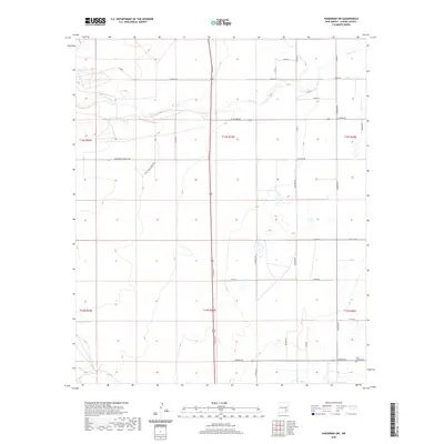
2020 Map of Hagerman SW
USGS Topo · Published 2020About this map
Rio Felix meanders through this portion of Chaves County, defining the hydrologic character of a landscape partitioned by an orderly grid of rural roads and section lines. The map reveals a transition from the drainage of the river in the north to a drier southern expanse marked by a network of thoroughfares with distinct cultural identifiers, such as Sagebrush Valley Rd, Choctaw Rd, and Navajo St. In the southeastern corner, the Lake Arthur Cem serves as a significant landmark for genealogical research, situated near the intersection of Pueblo Rd and Cherokee Rd. The cartography emphasizes the intersection of natural drainage and modern infrastructure, including the prominent north-south corridor of SE Main St, which bisects the townships of t14s r25e and t15s r25e.
Find a feature on this map
34 named features on this map. Tap any name to fly to it.
Don’t see what you’re looking for? This feature index may not catch every label — zoom into the map to look around manually.
Map Details
Editions of this 2020 Hagerman SW Map
This is the sole edition of this map. No revisions or reprints were ever made.
Other maps of this area

1949 · Peters Lake
USGS Topo · 1:24,000

1950 · Dexter West
USGS Topo · 1:24,000

1950 · Dexter East
USGS Topo · 1:24,000

1951 · Hagerman
USGS Topo · 1:24,000

1952 · Hagerman SW
USGS Topo · 1:24,000

1953 · Espuela
USGS Topo · 1:24,000

1954 · Carlsbad
USGS Topo · 1:250,000

1955 · Artesia NE
USGS Topo · 1:24,000

1955 · Hackberry Ranch
USGS Topo · 1:24,000

1955 · Hope NE
USGS Topo · 1:24,000