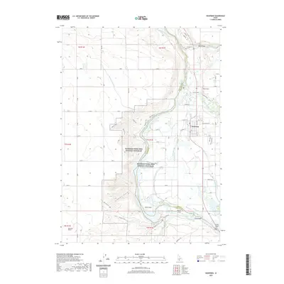
2020 Map of Hagerman
USGS Topo · Published 2020About this map
Hagerman Fossil Beds National Monument dominates the western bluffs above the Snake River, preserving a significant paleontological landscape where the high desert meets the river valley. The town of Hagerman sits on the eastern terrace, surrounded by an intricate network of irrigation infrastructure including the King Hill Main Canal, Sands Ditch, and Buckeye Ditch. This 2020 survey illustrates how water management has transformed the arid terrain near the Bruneau Desert into a productive agricultural corridor.
Find a feature on this map
64 named features on this map. Tap any name to fly to it.
Don’t see what you’re looking for? This feature index may not catch every label — zoom into the map to look around manually.
Map Details
Editions of this 2020 Hagerman Map
This is the sole edition of this map. No revisions or reprints were ever made.
Other maps of this area

1948 · Ticeska
USGS Topo · 1:24,000

1949 · Ticeska
USGS Topo · 1:24,000

1949 · Pasadena Valley
USGS Topo · 1:62,500

1949 · Bliss
USGS Topo · 1:24,000

1949 · Thousand Springs
USGS Topo · 1:24,000

1949 · Gooding Butte
USGS Topo · 1:24,000

1949 · Tuttle
USGS Topo · 1:24,000

1949 · Hagerman
USGS Topo · 1:24,000

1949 · Indian Butte
USGS Topo · 1:24,000

1950 · Gooding Butte
USGS Topo · 1:24,000