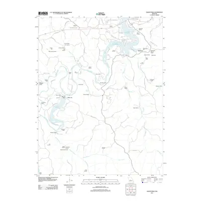
2011 Map of Hahatonka
USGS Topo · Published 2011About this map
Ha Ha Tonka State Park anchors this landscape, showcasing remarkable geologic formations including the Hahatonka Natural Bridge, the Devils Kitchen, and several major sinkholes like Black Sink and Red Sink. The terrain is defined by the winding course of the Niangua River, which feeds into the southern arms of the Lake of the Ozarks. This 2011 survey captures the area's hydroelectric and recreational footprint, from the Niangua River Dam and Tunnel Dam creating Lake Niangua to the numerous lake-access roads serving residential pockets around Hahatonka and Roach. Family history is well-preserved across the rugged topography, with several burial sites such as Union Electric Cemetery, Laughlin Cemetery, and Webster Cemetery situated near prominent bluffs like Stover Bluff and Darby Bluff. The map also reveals numerous named hollows, including Moonshine Hollow and Turkeypen Hollow, which trace the drainage patterns toward the river valley.
Find a feature on this map
79 named features on this map. Tap any name to fly to it.
Don’t see what you’re looking for? This feature index may not catch every label — zoom into the map to look around manually.
Map Details
Editions of this 2011 Hahatonka Map
This is the sole edition of this map. No revisions or reprints were ever made.
Other maps of this area

1888 · Versailles
USGS Topo · 1:125,000

1893 · Versailles
USGS Topo · 1:125,000

1932 · Versailles No 4
USGS Topo · 1:48,000

1933 · Stoutland
USGS Topo · 1:62,500

1934 · Macks Creek
USGS Topo · 1:48,000

1934 · Camdenton
USGS Topo · 1:24,000

1934 · Green Bay Terrace
USGS Topo · 1:24,000

1935 · Barnumton
USGS Topo · 1:24,000

1938 · Stoutland
USGS Topo · 1:62,500

1939 · Macks Creek
USGS Topo · 1:62,500