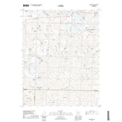
2017 Map of Hahatonka
USGS Topo · Published 2017About this map
The Niangua Arm of the Lake of the Ozarks dominates this landscape, where the water has flooded deeply into the hollows of Camden and Dallas Counties. This 2017 survey reveals a complex shoreline where steep bluffs like Stover Bluff and Nettles Bluff meet the rising waters. Further south, Lake Niangua is fed by the Niangua River, which snakes through a series of dramatic vertical features including Darby Bluff and Kirkland Bluff.
Find a feature on this map
151 named features on this map. Tap any name to fly to it.
Don’t see what you’re looking for? This feature index may not catch every label — zoom into the map to look around manually.
Map Details
Editions of this 2017 Hahatonka Map
This is the sole edition of this map. No revisions or reprints were ever made.
Other maps of this area

1888 · Versailles
USGS Topo · 1:125,000

1893 · Versailles
USGS Topo · 1:125,000

1932 · Versailles No 4
USGS Topo · 1:48,000

1933 · Stoutland
USGS Topo · 1:62,500

1934 · Macks Creek
USGS Topo · 1:48,000

1934 · Camdenton
USGS Topo · 1:24,000

1934 · Green Bay Terrace
USGS Topo · 1:24,000

1935 · Barnumton
USGS Topo · 1:24,000

1938 · Stoutland
USGS Topo · 1:62,500

1939 · Macks Creek
USGS Topo · 1:62,500