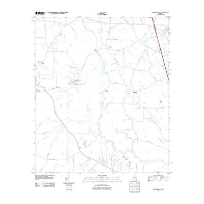
2011 Map of Hahira West
USGS Topo · Published 2011About this map
Morven and the community of Shiloh anchor this South Georgia landscape, where agricultural land and dense river bottoms meet. The winding course of the Little River and its many tributaries, including Slaughter Creek and Franks Creek, define the local geography and historical property boundaries. The area is marked by several small family and community burial grounds, such as Hall Cemetery, Corinth Cemetery, and the Redding Cemetery, which provide valuable touchpoints for genealogical research in this rural portion of Lowndes and Brooks Counties. A distinct pattern of small private airfields emerges in the south and east, including Lace Airport, Paso Fino Farm Airport, and Shilo Farms Airport, indicating the intersection of modern aviation with traditional farming and ranching. Water management for local use is evidenced by the systems at Lawson Pond, where both Lawson Pond Dam Number One and Lawson Pond Dam Number Two are clearly identified.
Find a feature on this map
68 named features on this map. Tap any name to fly to it.
Don’t see what you’re looking for? This feature index may not catch every label — zoom into the map to look around manually.
Map Details
Editions of this 2011 Hahira West Map
This is the sole edition of this map. No revisions or reprints were ever made.
Other maps of this area

1953 · Waycross
USGS Topo · 1:250,000

1954 · Valdosta
USGS Topo · 1:250,000

1958 · Valdosta
USGS Topo · 1:250,000

1958 · Waycross
USGS Topo · 1:250,000

1959 · Valdosta
USGS Topo · 1:250,000

1961 · Hahira East
USGS Topo · 1:24,000

1961 · Quitman
USGS Topo · 1:62,500

1961 · Valdosta
USGS Topo · 1:24,000

1961 · Hahira West
USGS Topo · 1:24,000

1961 · Ousley
USGS Topo · 1:24,000