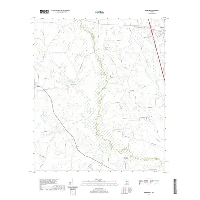
2020 Map of Hahira West
USGS Topo · Published 2020About this map
Lowndes and Brooks Counties meet along a densely wooded river corridor in this recent topographic study of the South Georgia landscape. The area is characterized by a high concentration of wetlands and intricate drainage patterns, with the primary watercourse winding through the center of the sheet and feeding various small ponds and tributaries. Agriculture and low-density residential development define the upland areas, where a network of local roads connects scattered homesteads and farming operations. The proximity to the town center is evident in the northeast, though most of the terrain remains focused on rural land use and natural resource management. While specific label data was not provided for this record, the map depicts the essential physical geography and modern infrastructure of this rural corridor as it appeared during the late 2010s.
Map Details
Editions of this 2020 Hahira West Map
This is the sole edition of this map. No revisions or reprints were ever made.
Other maps of this area

1953 · Waycross
USGS Topo · 1:250,000

1954 · Valdosta
USGS Topo · 1:250,000

1958 · Valdosta
USGS Topo · 1:250,000

1958 · Waycross
USGS Topo · 1:250,000

1959 · Valdosta
USGS Topo · 1:250,000

1961 · Hahira East
USGS Topo · 1:24,000

1961 · Quitman
USGS Topo · 1:62,500

1961 · Valdosta
USGS Topo · 1:24,000

1961 · Hahira West
USGS Topo · 1:24,000

1961 · Ousley
USGS Topo · 1:24,000