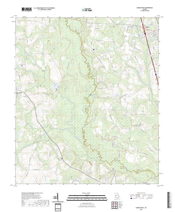
2024 Map of Hahira West
USGS Topo · Published 2024About this map
The Little River meanders southward through this South Georgia landscape, forming a natural boundary between Brooks and Lowndes counties. This 2024 survey documents the agricultural and rural character of the region, anchored by the towns of Hahira and Morven. While Hahira shows modern development along its streets like W Main St and W Park St, the surrounding area remains defined by legacy family farms and small historic markers. Several small family burial grounds, including Corinth Cem, Redding Cem, and Rizer Cem, are scattered among the fields, providing important points of interest for genealogists tracing local families. The presence of the Paso Fino Farm Airport and Hidden River Run suggests the ongoing evolution of the land use, while numerous watercourses like Slaughter Creek and Franks Creek drain the low-lying terrain toward the river.
Find a feature on this map
74 named features on this map. Tap any name to fly to it.
Don’t see what you’re looking for? This feature index may not catch every label — zoom into the map to look around manually.
Map Details
Editions of this 2024 Hahira West Map
This is the sole edition of this map. No revisions or reprints were ever made.
Other maps of this area

1953 · Waycross
USGS Topo · 1:250,000

1954 · Valdosta
USGS Topo · 1:250,000

1958 · Valdosta
USGS Topo · 1:250,000

1958 · Waycross
USGS Topo · 1:250,000

1959 · Valdosta
USGS Topo · 1:250,000

1961 · Hahira East
USGS Topo · 1:24,000

1961 · Quitman
USGS Topo · 1:62,500

1961 · Valdosta
USGS Topo · 1:24,000

1961 · Hahira West
USGS Topo · 1:24,000

1961 · Ousley
USGS Topo · 1:24,000