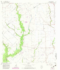
1965 Map of Hahn
USGS Topo · Published 1983About this map
The boundary between Colorado and Wharton Counties runs through this coastal prairie landscape, where the local economy in the mid-1960s was clearly defined by agricultural infrastructure and energy extraction. The small community of Hahn serves as a focal point, supported by the nearby Hahn Cem and Mt Pilgrim Ch. Economic activity is visible through the presence of the Raun Rice Dryer, reflecting the region's rice-growing heritage, alongside numerous Oil Wells and Gas Wells that dot the fields.
Find a feature on this map
20 named features on this map. Tap any name to fly to it.
Don’t see what you’re looking for? This feature index may not catch every label — zoom into the map to look around manually.
Map Details
Editions of this 1965 Hahn Map
2 editions found
Other maps of this area

1953 · Seguin
USGS Topo · 1:250,000

1958 · Seguin
USGS Topo · 1:250,000

1959 · Garwood
USGS Topo · 1:24,000

1959 · Bonus
USGS Topo · 1:24,000

1960 · New Taiton
USGS Topo · 1:24,000

1965 · El Campo
USGS Topo · 1:24,000
1965 · Sheridan NE
USGS Topo · 1:24,000

1965 · Ganado NE
USGS Topo · 1:24,000

1965 · Sheridan SE
USGS Topo · 1:24,000

1965 · Gobbler Creek
USGS Topo · 1:24,000