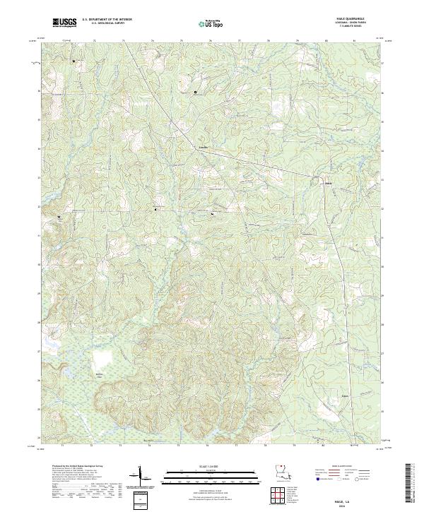
2024 Map of Haile
USGS Topo · Published 2024About this map
Linville and Haile anchor this portion of Union Parish, situated in a landscape defined by the winding course of Bayou de Loutre and its numerous tributaries. The map reveals a rural network of named parish roads and timbered tracts, punctuated by landmarks such as Buffalo Hole and Big Island. To the east, the boundary of the Upper Ouachita National Wildlife Refuge marks a transition into the bottomlands along the river system. Genealogists will find significant value in the distribution of family and community burial sites, including Crow Cem, Abstent Cem, and Macedonia Cem. The southern edge of the map shows the community of Upco near the confluence of Miller Creek and Cook Creek, illustrating the settlement patterns that followed the region's water and road corridors.
Find a feature on this map
81 named features on this map. Tap any name to fly to it.
Don’t see what you’re looking for? This feature index may not catch every label — zoom into the map to look around manually.
Map Details
Editions of this 2024 Haile Map
This is the sole edition of this map. No revisions or reprints were ever made.
Other maps of this area

1935 · Drew
USGS Topo · 1:62,500

1935 · Haile
USGS Topo · 1:62,500

1952 · Calhoun
USGS Topo · 1:62,500

1952 · Farmerville
USGS Topo · 1:62,500

1955 · Shreveport
USGS Topo · 1:250,000

1956 · Shreveport
USGS Topo · 1:250,000

1956 · Haile
USGS Topo · 1:62,500

1957 · Monroe North
USGS Topo · 1:62,500
1969 · Monroe North
USGS Topo · 1:62,500
1982 · Point
USGS Topo · 1:24,000