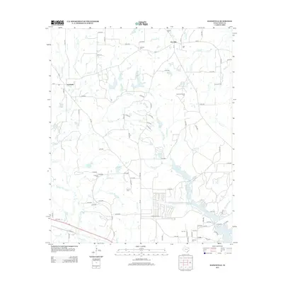
2012 Map of Hainesville
USGS Topo · Published 2012About this map
Hainesville and Pine Mills anchor this Wood County landscape, where the natural hydrology of East Texas meets late-twentieth-century industrial development. The map reveals a transition from traditional rural landmarks to energy extraction, notably the Shirley Barbara Oil Field and Dupree Oil Field situated north of the Fouke community. Genealogists will find a high concentration of burial sites, including Redlands Cem, Mt Pisgah Cem, and the Old Fouke Cem near the southern edge. The area is defined by a complex network of waterways like Patton Cr and Little Sandy Cr, which feed into numerous small impoundments such as Puckett Lake and Indian Mound Lake. The recurrence of the Mill Race label across several drainages hints at the region's earlier industrial reliance on water power for milling before the expansion of modern oil and gas infrastructure.
Find a feature on this map
116 named features on this map. Tap any name to fly to it.
Don’t see what you’re looking for? This feature index may not catch every label — zoom into the map to look around manually.
Map Details
Editions of this 2012 Hainesville Map
This is the sole edition of this map. No revisions or reprints were ever made.
Other maps of this area

1956 · Tyler
USGS Topo · 1:250,000

1960 · Shady Grove
USGS Topo · 1:24,000

1960 · Hawkins
USGS Topo · 1:24,000

1960 · Hainesville
USGS Topo · 1:24,000

1960 · Lindale
USGS Topo · 1:24,000

1960 · Mineola
USGS Topo · 1:24,000

1960 · Cartwright
USGS Topo · 1:24,000

1960 · Rhonesboro
USGS Topo · 1:24,000

1960 · Crow
USGS Topo · 1:24,000

1960 · Quitman
USGS Topo · 1:24,000