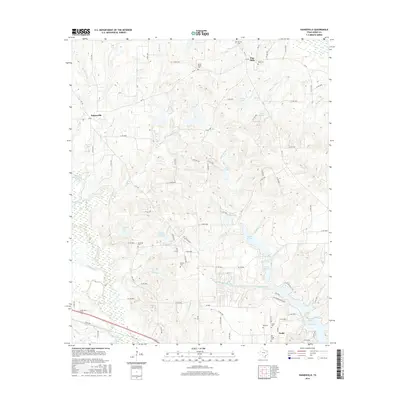
2016 Map of Hainesville
USGS Topo · Published 2016About this map
Pine Mills and Fouke anchor this East Texas landscape, where a dense network of country roads and small water bodies defines the local geography. Numerous family-named burial grounds like Mount Pisgah Cem, Gentry Cem, and Mansell Cem are scattered across the terrain, offering significant points of interest for genealogists tracing regional lineages. The hydrology of the area is particularly complex, characterized by features such as the Mill Race and several small reservoirs including Indian Mound Lake, Brooks Lake, and Shipps Lake. Near the settlement of Hainesville, the landscape transitions between creek drainages like Patton Cr and Little Sandy Cr, illustrating the typical rural development pattern of Wood County during this period. The survey documents a community tied to the land, with legacy sites like Old Fouke Cem situated near modern thoroughfares.
Find a feature on this map
107 named features on this map. Tap any name to fly to it.
Don’t see what you’re looking for? This feature index may not catch every label — zoom into the map to look around manually.
Map Details
Editions of this 2016 Hainesville Map
This is the sole edition of this map. No revisions or reprints were ever made.
Other maps of this area

1956 · Tyler
USGS Topo · 1:250,000

1960 · Shady Grove
USGS Topo · 1:24,000

1960 · Hawkins
USGS Topo · 1:24,000

1960 · Hainesville
USGS Topo · 1:24,000

1960 · Lindale
USGS Topo · 1:24,000

1960 · Mineola
USGS Topo · 1:24,000

1960 · Cartwright
USGS Topo · 1:24,000

1960 · Rhonesboro
USGS Topo · 1:24,000

1960 · Crow
USGS Topo · 1:24,000

1960 · Quitman
USGS Topo · 1:24,000