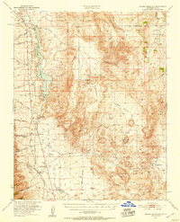
1951 Map of Haiwee Reservoir
USGS Topo · Published 1957About this map
The Los Angeles Aqueduct and the Haiwee Reservoir dominate the western edge of this Inyo County landscape, illustrating the critical mid-century infrastructure redirecting water from the Owens Valley. To the east, the terrain rises into the volcanic and geothermal features of the Coso Range, where evidence of ancient and modern activity meets. Locations like Indian Petroglyphs sit in proximity to industrial and geothermal sites such as the Thorndyke Mine and the steaming fumaroles of Coso Hot Springs. Small settlements and travel stops like Dunmovin, Coso Junction, and Rose Spring line the corridor of U S Highway 395 and the Southern Pacific railroad. The map also records several family-named landmarks and ranch sites, including Lewis Ranch and Sykes, providing a record of habitation in the shadow of Sugarloaf Mountain and the high basins of Cactus Flat.
Find a feature on this map
55 named features on this map. Tap any name to fly to it.
Don’t see what you’re looking for? This feature index may not catch every label — zoom into the map to look around manually.
Map Details
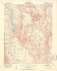
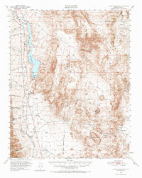
Editions of this 1951 Haiwee Reservoir Map
4 editions found

Other maps of this area

1905 · Olancha
USGS Topo · 1:125,000

1906 · Kernville
USGS Topo · 1:125,000

1907 · Olancha
USGS Topo · 1:125,000

1908 · Kernville
USGS Topo · 1:125,000

1908 · Ballarat
USGS Topo · 1:250,000

1913 · Ballarat
USGS Topo · 1:250,000

1915 · Searles Lake
USGS Topo · 1:250,000

1947 · Trona
USGS Topo · 1:250,000

1948 · Trona
USGS Topo · 1:250,000

1948 · Death Valley
USGS Topo · 1:250,000