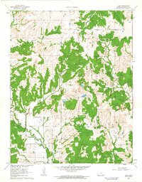
1962 Map of Hale
USGS Topo · Published 1963About this map
Hale and Monett anchor this rural landscape in Chautauqua County, where the transition from rail to road is clearly visible. An Old Railroad Grade cuts across the terrain, reflecting a shift in the local economy as it bypasses the small clusters of Belleville and Broker. The area is defined by its deep history of land use, including active extraction at a Quarry and various Oil Wells, particularly concentrated in the western Oil Field. Genealogists will find significant value in the documentation of local burial sites like Hale Cem, Hardrock Cem, and Riley Cem, which remain as fixed points in a changing countryside. The drainage network is complex, featuring evocative names such as Possum Trot and Deadman Creek, while the historic California Road provides a direct link to early transportation corridors through Salt Creek valley.
Find a feature on this map
24 named features on this map. Tap any name to fly to it.
Don’t see what you’re looking for? This feature index may not catch every label — zoom into the map to look around manually.
Map Details
Editions of this 1962 Hale Map
2 editions found
Other maps of this area

1885 · Sedan
USGS Topo · 1:125,000

1886 · Independence
USGS Topo · 1:125,000

1889 · Sedan
USGS Topo · 1:125,000

1894 · Independence
USGS Topo · 1:125,000

1905 · Independence
USGS Topo · 1:125,000

1947 · Joplin
USGS Topo · 1:250,000

1949 · Joplin
USGS Topo · 1:250,000

1954 · Joplin
USGS Topo · 1:250,000

1955 · Wichita
USGS Topo · 1:250,000

1958 · Wichita
USGS Topo · 1:250,000