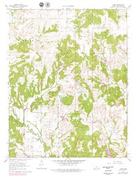
1962 Map of Hale
USGS Topo · Published 1979About this map
Hale and Monett serve as central points in this landscape of southeast Kansas, which is defined by an extensive network of waterways and early industrial activity. The presence of an Old Railroad Grade winding through the northern sections provides a clear trace of former transit corridors that once connected these rural settlements. This 1962 survey, updated with 1970s photogrammetric data, reveals the significance of the energy sector in Sedan and Washington townships, where scattered Gas Wells and a dedicated Oil Field sit alongside agricultural land.
Find a feature on this map
26 named features on this map. Tap any name to fly to it.
Don’t see what you’re looking for? This feature index may not catch every label — zoom into the map to look around manually.
Map Details
Editions of this 1962 Hale Map
2 editions found
Other maps of this area

1885 · Sedan
USGS Topo · 1:125,000

1886 · Independence
USGS Topo · 1:125,000

1889 · Sedan
USGS Topo · 1:125,000

1894 · Independence
USGS Topo · 1:125,000

1905 · Independence
USGS Topo · 1:125,000

1947 · Joplin
USGS Topo · 1:250,000

1949 · Joplin
USGS Topo · 1:250,000

1954 · Joplin
USGS Topo · 1:250,000

1955 · Wichita
USGS Topo · 1:250,000

1958 · Wichita
USGS Topo · 1:250,000