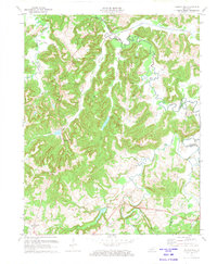
1972 Map of Haleys Mill
USGS Topo · Published 1973About this map
Family-named cemeteries and small crossroads settlements dot the landscape of Christian County in this 1970s record of rural Kentucky. The terrain is defined by the winding course of the Pond River and its various forks, including the West Fork Pond River and Buck Fork. A heavy concentration of Oil Wells is visible across the northern half of the quadrangle, particularly near the Muhlenberg County line, suggesting a period of active resource extraction.
Find a feature on this map
39 named features on this map. Tap any name to fly to it.
Don’t see what you’re looking for? This feature index may not catch every label — zoom into the map to look around manually.
Map Details
Editions of this 1972 Haleys Mill Map
2 editions found
Other maps of this area

1911 · Drakesboro
USGS Topo · 1:48,000

1912 · Nortonville
USGS Topo · 1:62,500

1913 · Drakesboro
USGS Topo · 1:62,500

1952 · Kelly
USGS Topo · 1:24,000

1952 · Allegre
USGS Topo · 1:24,000

1952 · Honey Grove
USGS Topo · 1:24,000

1952 · Greenville
USGS Topo · 1:24,000

1952 · Crofton
USGS Topo · 1:24,000

1953 · Haleys Mill
USGS Topo · 1:24,000

1953 · Nortonville
USGS Topo · 1:24,000