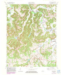
1972 Map of Haleys Mill
USGS Topo · Published 1983About this map
Haleys Mill and Apex anchor this rural landscape in the 1970s, where the headwaters of the Pond River and its West Fork carve through the hills of northern Christian County. The area is defined by a dense network of family cemeteries and rural congregations, including Judge Coon Chapel and Pleasant View Ch, which served the small settlements of Fruit Hill and Dulin. The presence of numerous Oil Wells along the northern reaches and Erkelican Coal Creek to the west points to a landscape defined by resource extraction and agriculture. Several flood control structures, such as Dam No 7B on Bull Creek, highlight the 20th-century management of the local watershed. This survey captures a moment when traditional land ownership and community centers remained clearly visible alongside mid-century infrastructure and energy development.
Find a feature on this map
44 named features on this map. Tap any name to fly to it.
Don’t see what you’re looking for? This feature index may not catch every label — zoom into the map to look around manually.
Map Details
Editions of this 1972 Haleys Mill Map
2 editions found
Other maps of this area

1911 · Drakesboro
USGS Topo · 1:48,000

1912 · Nortonville
USGS Topo · 1:62,500

1913 · Drakesboro
USGS Topo · 1:62,500

1952 · Kelly
USGS Topo · 1:24,000

1952 · Allegre
USGS Topo · 1:24,000

1952 · Honey Grove
USGS Topo · 1:24,000

1952 · Greenville
USGS Topo · 1:24,000

1952 · Crofton
USGS Topo · 1:24,000

1953 · Haleys Mill
USGS Topo · 1:24,000

1953 · Nortonville
USGS Topo · 1:24,000