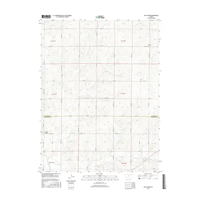
2015 Map of Half Mound
USGS Topo · Published 2015About this map
Half Mound and the surrounding farmland of Jefferson and Atchison counties are defined by a high-density network of section-line roads and winding creek valleys. The landscape is bisected by the Delaware River in the southwest and drained by several prominent waterways, including Coal Cr and N Walnut Cr. This survey illustrates a rural Kansas interior where the local topography dictated the placement of small community hubs and cemeteries. Genealogists will find several notable burial sites preserved here, such as Coal Creek Cem and Neill Cem, alongside the Pleasant Grove Cem in the northeast. The land is organized into a grid of rural routes like Andy White Rd and ChautAUQUA Rd, which connect the scattered homesteads and local landmarks like Earnst to the regional geography.
Find a feature on this map
44 named features on this map. Tap any name to fly to it.
Don’t see what you’re looking for? This feature index may not catch every label — zoom into the map to look around manually.
Map Details
Editions of this 2015 Half Mound Map
This is the sole edition of this map. No revisions or reprints were ever made.
Other maps of this area

1885 · Atchison
USGS Topo · 1:125,000

1886 · Oskaloosa
USGS Topo · 1:125,000

1888 · Oskaloosa
USGS Topo · 1:125,000

1888 · Atchison
USGS Topo · 1:125,000

1888 · Hiawatha
USGS Topo · 1:125,000

1889 · Topeka
USGS Topo · 1:125,000

1893 · Atchison
USGS Topo · 1:125,000

1894 · Oskaloosa
USGS Topo · 1:125,000

1894 · Topeka
USGS Topo · 1:125,000

1894 · Hiawatha
USGS Topo · 1:125,000