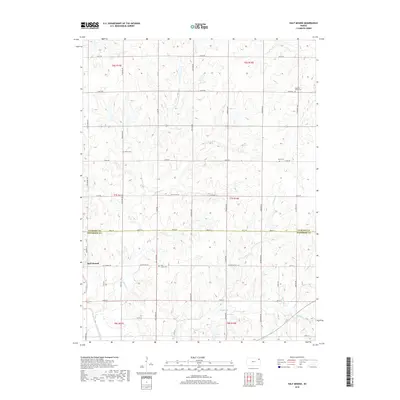
2018 Map of Half Mound
USGS Topo · Published 2018About this map
The settlement of Half Mound serves as the focal point of this Jefferson County landscape, situated where the terrain begins its descent toward the Delaware River valley. The map documents a predominantly agrarian community defined by a dense grid of rural roads and a series of stream valleys, including Coal Cr, Walnut Cr, and its northern branch, N Walnut Cr. Local history is anchored by several well-distributed burial grounds, such as Pleasant Grove Cem and Coal Creek Cem, which often represent the earliest established landmarks in the townships of this region. The drainage patterns of Johannes Br and other small tributaries show how the land has been carved into a series of ridges and draws, a geography that dictated the placement of homesteads and the winding paths of routes like Chautauqua Rd and Coal Creek Rd.
Find a feature on this map
44 named features on this map. Tap any name to fly to it.
Don’t see what you’re looking for? This feature index may not catch every label — zoom into the map to look around manually.
Map Details
Editions of this 2018 Half Mound Map
This is the sole edition of this map. No revisions or reprints were ever made.
Other maps of this area

1885 · Atchison
USGS Topo · 1:125,000

1886 · Oskaloosa
USGS Topo · 1:125,000

1888 · Oskaloosa
USGS Topo · 1:125,000

1888 · Atchison
USGS Topo · 1:125,000

1888 · Hiawatha
USGS Topo · 1:125,000

1889 · Topeka
USGS Topo · 1:125,000

1893 · Atchison
USGS Topo · 1:125,000

1894 · Oskaloosa
USGS Topo · 1:125,000

1894 · Topeka
USGS Topo · 1:125,000

1894 · Hiawatha
USGS Topo · 1:125,000